


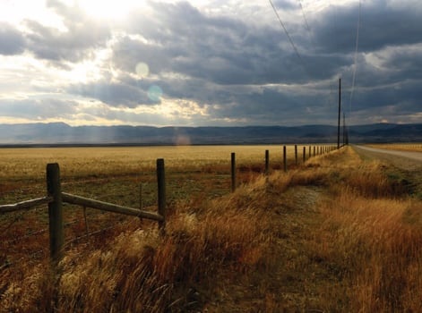
As a semi-arid climate, water availability may become a more dominant consideration for future development
The water conundrum: A limited resource, a cacophony of voices and a region that continues to grow
By Lewis Kendall Chronicle Staff Writer May 6, 2018
It’s runoff season and Sourdough Creek, bloated and brown from sediment dragged down by snow from nearby peaks, emerges torrential from the mouth of the Gallatin Range.
Watching from its bank, it’s difficult to imagine the creek, which provides nearly half the drinking water to Bozeman’s some 48,000 residents, as anything less than infinite.
But in the Gallatin Valley, where sources like Sourdough have been largely shut off to new extraction for the last 25 years, water is both limited and coveted. And as it spreads increasingly thin, a cluster of farmers, landowners, conservationists and officials are attempting to figure out how to make the most of a dwindling resource.
Water, water, everywhere
Around here, water begins and ends with the Gallatin River.
Rising in Wyoming in the very northwest corner of Yellowstone National Park, the river meanders north, splitting the Gallatin and Madison mountain ranges before hanging a sharp west turn outside Manhattan, eventually joining with the Jefferson and Madison at the headwaters of the Missouri.
Gallatin County itself is part of the Upper Missouri River Basin, a drainage area that encompasses much of the southwestern chunk of the state.
Hyalite and Sourdough creeks, tributaries of the Gallatin that feed off snowmelt, provide the vast majority of Bozeman’s potable water. The rest comes from a freshwater spring, Lyman Creek, on the north side of town.
The water, as much as 12 million gallons of it per day, is pumped from the three creeks to a treatment plant in Sourdough Canyon, then to one of several storage facilities, and finally through some 300 miles of underground pipes before ending up in your glass, tub or sprinkler.
Through these sources, the city has access to more than 3.7 billion gallons of water every year. That might sound like a lot, but the math doesn’t pencil out quite as rosy.
Bozeman residents (not including agricultural users) consume an average of 111 gallons of water each day, and if the city’s population continues to grow apace, demand is set to outstrip supply as soon as 2030.
Seated in his office downtown, Craig Woolard, the city’s public works director, pulls up a Malthusian-looking chart, pointing to the intersection between the upward curve of population and the flat line of water supply.
That, Woolard says, is where the rubber meets the road.
“As we grow, ensuring water supply is probably the single biggest challenge to sustainability for the city,” he says.
New subdivisions are required to either provide their own water to the city or pay cash in lieu. With the former hard to come by, most opt for the latter — Bozeman collected more than $900,000 in cash in lieu payments in 2017, the majority of which is spent buying water from other owners.
With the city continuing to add five new residents every day, Woolard says his department has adopted a three-pronged approach to the area’s water future. First up on the list is conservation.
Nearly a third of the water used in the city goes toward watering lawns (in the summertime, that proportion jumps to half) and Woolard and the city’s Water Conservation Division have zeroed in on residential irrigation as the “low-hanging fruit” where Bozeman can help stretch its supply.
The city offers a handful of rebates to encourage households to limit their outdoor watering, as well as free sprinkler system assessments. It’s not a lot, but like anything, it can add up, Woolard says.
“All those little actions, when multiplied by 50,000, can have a big impact,” he says.
The second approach is to optimize existing infrastructure to ensure the city isn’t losing water, or money, anywhere along the line. The $50 million Sourdough treatment plant was a good start, and should last the city decades, Woolard says. A new, $8.8 million storage facility near the mouth of Sourdough Canyon was another step in the right direction. The miles of pipes are in pretty good shape, although the city would like to add redundancy to a few arterial segments where a break could spell disaster.
The third and final step in securing the city’s water future, according to Woolard, is developing new sources. It’s the last option because it’s not only the most expensive (one gallon of water costs five times as much to buy as it does to conserve), but the trickiest as well.
The city has budgeted a further $8 million to identify and build a new groundwater well, much of which would go toward a complicated process called mitigation.
In a 2006 decision, the Montana Supreme Court deemed groundwater (water pulled from an underground aquifer) directly connected to the surface water flowing in streams, rivers and reservoirs. The ruling meant that groundwater users now have to mitigate their use, in essence requiring they put back in the same amount they take out. Many do this by obtaining separate surface water rights and filtering water down into the aquifer.
+6
Gallatin Valley river systems
A map of the Gallatin Valley’s river systems, courtesy of the Montana Natural Resource Information System and the Montana Bureau of Mines and Geology.
Acquiring water rights, though, is easier said than done.
Montana, like many states in the West, operates under what is known as the prior appropriation doctrine, which, as explained by Kerri Strasheim, regional manager at the Montana Department of Natural Resources and Conservation, means “first in time is first in rights.”
Settlers in the valley began claiming water as soon as they arrived (some of the earliest water rights are from the 1860s) and the current system is overseen by the DNRC and the Montana Water Courts. The rights themselves are massive documents that detail from where water will be diverted (often through ditch systems connected to the Gallatin River), how much will be used (typically measured in acre-feet, or the amount of water it takes to fill a square acre to the depth of 12 inches) as well as when and how it will be used.
There are more than 15,000 rights holders in the valley, from individual landowners to farmers and ranchers to municipalities like the city of Bozeman.
The best way to understand the system, according to Strasheim, is to visualize water flow as a parabola — peaking when runoff is highest in the spring and early summer — bisected by a flat line representing the total amount of water claimed through the rights system. When flows are high, most users get a chance to exercise their right. But when flows drop below claimed amounts, those with the oldest, most senior rights get first dibs, then on down the line until the water runs out.
Despite state legislators voting to close the basin to new rights claims in 1993 (rights still regularly change hands and forms), holders claim far more water than is typically available, creating what Strasheim calls an “over-appropriated” system.
“There’s no new water available, but there are a lot of new demands on water, so how to best manage it is the biggest issue,” she says.
‘All sides are going to have to give a little’
If water issues in Bozeman are a tangled rope, outside city limits they are nothing less than a knotted mess.
Belgrade, Three Forks and Manhattan all have their own well-based municipal systems, drawing water from the valley’s expansive underground aquifer and piping it to homes and businesses.
But those not tapped into city systems are hooked up through one of the handful of water and sewer districts, or have individual wells — 17,000 of which dot the county.
These districts are born from growth. In order to meet demand and comply with the law, developers proposing large subdivisions outside city limits build miniature versions of municipal water and sewer systems, again typically drawing from groundwater. Once completed, the systems are traditionally sold to the county and made public.
But rather than build capacity in advance of growth, districts prove more reactive, adding infrastructure in response to new homes proposed by developers, who front the costs and are later repaid through user fees.
David King, manager for RAE Water and Sewer District, which provides services to a node of homes off Gooch Hill Road, explains the situation as black and white.
“We’re not responsible for providing for expansion or growth. That’s something cities and towns do,” King says. “Our job is to service our existing customers. That’s it, period.”
The Gallatin County Commission has its own vision for growth, which includes steering new building toward already developed areas. But as far as water and sewer, expansion is almost exclusively driven by private developers, leading to systems that are often tapped to capacity.
“The system builds itself where it’s advantageous to grow,” King says. “When you try to impose structure from the outside, sometimes it doesn’t work.”
Individual wells are also a point of contention. Montana has long operated under an exempt well rule, which allows anyone with a drill and a will to build wells and draw a certain amount (10 acre-feet per year) of groundwater without a permit. By some metrics, a single well can supply enough water for 40 households, and developers have historically used the well rule to avoid paying for more expensive systems. Some two-thirds of subdivision lots built in the state between 2004 and 2011 drew water from exempt wells, according to one report.
But farmers, ranchers and senior rights holders argue the exemption is a threat to existing users and potentially to water systems as a whole.
Walt Sales, a state legislator and member of the Association of Gallatin Agricultural Irrigators, operates with the same water right his great-grandfather claimed after digging a ditch on some land in Amsterdam in 1865. To Sales, the well issue is a slippery slope.
“With a few of them it wasn’t that bad, but all of a sudden it’s death by a thousand straws,” he says. “I’ve never heard the ag community say they don’t want the exemption, but they don’t want the proliferation (of wells) to take away from their use.”
Sales farms a bit of everything — potatoes, grain, hay — and has plenty of thoughts about water. In his eyes, between supply and demand, it’s a system in fine balance. But population growth and development pressures have begun to weight one side of the scale, necessitating well-informed planning and action that includes myriad water-related voices, from the ag community and towns to conservation groups such as the Greater Gallatin Watershed Council and agencies like the Gallatin Water Quality District.
“As a sustainable valley, we have to look at what is an acceptable normal and how do we maintain that through agricultural use, municipal use and industry,” he says. “All sides are going to have to give a little.”
The first steps, he says, are education and conversation.
On the education side sits the Montana Bureau of Mines and Geology. Tom Michalek, a senior research hydrogeologist with the MBMG, has spent several years studying water systems in the valley. Based out of Montana Tech in Butte, the department keeps tabs on both surface water levels, as well as the wells that pepper the map like holes in a sieve.
Michalek and his colleagues are currently working to find out how the valley’s aquifer has changed over the past half-century, comparing modern data to an extensive USGS study of the area’s water systems performed back in the 1950s. Though the findings haven’t been finalized, Michalek says that overall the aquifer hasn’t changed much. But, he cautioned, “That doesn’t mean there will never be a change in the future.”
Michalek’s main concern lies with how land use changes may affect the way groundwater recharges. The hydrogeologist compares the Gallatin Valley’s aquifer to a bathtub drained during the dry summer months and filled back up during the wet winter. More than half this refill comes from snowmelt permeating through the ground, with roughly another quarter directly attributable to farming irrigation practices.
The questions for Michalek are twofold: As the valley moves away from its farming roots, will the aquifer continue to recharge in the same way? And if not, what does that mean for water security?
Over the last 50 years, large segments of local farmland have morphed into subdivisions and commercial developments. Since 1992, the valley has lost roughly half (66,000 acres) of its irrigated land, according to data gathered by the Montana Natural Resource Information System. Michalek likes to reference a series of maps, on which a smattering of green represents irrigated lands and pink subdivisions. In the first map, dated 1953, the valley is swathed completely in green. In the second, a study of the 1990s, halos of pink begin to break up the green around Bozeman and Belgrade. By the third map, from 2010, the region resembles a fragmented jigsaw, with pink subdivisions expanding outward from their urban centers.
+6
1953 Land Use
A map of land use in the Gallatin Valley in 1953, courtesy of the Montana Natural Resource Information System and the Montana Bureau of Mines and Geology.
+6
2010 Land Use
A map of land use in the Gallatin Valley in 2010, courtesy of the Montana Natural Resource Information System and the Montana Bureau of Mines and Geology.
And then there’s the issue of climate change. Along with warming temperatures and more severe drought, the comprehensive Montana Climate Assessment released last year predicts many parts of the state will see both a decline in snowpack and a shift in precipitation, with more falling as rain and less as snow. All that spells changes for the timing and volume of runoff, as well as water systems as a whole, though what exactly it means for the aquifer is so far unclear, Michalek says.
For its part, the city of Bozeman has a reduction in water supply baked into its long-range projections, in addition to a detailed plan to address drought management. The city has also floated the idea of increasing the height of the Hyalite reservoir dam to preserve more water from runoff, but these plans would take at least a decade and millions of dollars.
“As long as we maintain that tub level year to year we won’t see many impacts,” Michalek says. “But that’s the question: Can we maintain that?”
Source: The water conundrum: A limited resource, a cacophony of voices and a region that continues to grow